Leveraging Machine Learning for Advanced Geological Mapping and Mineral Exploration
Xuan-Ce Wang
9/15/20253 min read
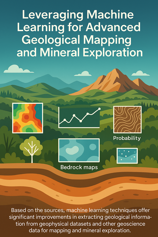
Machine learning techniques offer significant improvements in extracting geological information from geophysical datasets and other geoscience data for mapping and mineral exploration. This blog paper explores how machine learning enhances this process, providing a more efficient, objective, and insightful approach to understanding the Earth’s subsurface.
Introduction
Geophysical datasets—such as magnetic, radiometric, and gravity data—alongside other geoscience data like remotely sensed imagery, geochemistry, and geological maps, are critical for mapping and mineral exploration. Traditionally, extracting meaningful geological insights from these datasets has been a labor-intensive and subjective process. Machine learning revolutionizes this field by automating data integration, uncovering hidden patterns, and delivering actionable outputs like predictive maps. Below, we detail the key ways machine learning enhances this process.
Integration of Diverse Data
Machine learning allows for the integration of various geoscience data, including:
Geophysics: Magnetic, radiometric, and gravity data
Remotely sensed data: Spectral and radar imagery
Geochemistry: Chemical composition data
Digital elevation models (DEM): Topographic information
Existing geological maps: Pre-existing interpretations
Traditional manual methods struggle with the multi-dimensional analysis required to combine these datasets effectively. Machine learning algorithms, however, can process them simultaneously, identifying patterns and relationships across diverse data types that might otherwise be overlooked. This comprehensive integration lays the foundation for more accurate geological interpretations.
Identification of Complex Relationships
Machine learning algorithms, such as Random Forest and Support Vector Machines, excel at analyzing many input maps simultaneously—whether 10, 20, 100, or even 1000 maps. By processing these inputs, they uncover complex relationships between data patterns and known geological units or mineral occurrences. For example, these algorithms can identify the unique "signature" of different rock types or potential mineralization zones, providing a deeper understanding of subsurface geology that is critical for mapping and exploration.
Production of Predictive Maps
Using the relationships it learns, machine learning can classify pixels in raster data to produce a variety of predictive maps, such as:
Predictive bedrock maps: Showing subsurface rock types
Surficial material maps: Mapping surface sediments
Mineral prospectivity maps: Highlighting areas with mineral potential
Landslide susceptibility maps: Identifying at-risk zones
These maps transform raw data into actionable insights, guiding exploration efforts and environmental management with precision.
Objectivity and Speed
Machine learning offers a more objective approach than traditional methods, where human-drawn boundaries can introduce bias. By applying consistent criteria across datasets, it eliminates subjectivity. Additionally, the process is significantly faster, rapidly analyzing large volumes of data that would take humans far longer to interpret. This combination of objectivity and speed accelerates decision-making in exploration projects.
Mapping Under Cover
One of machine learning’s standout capabilities is its ability to map geology under cover. Models trained on areas with exposed geology can apply learned relationships to regions obscured by younger rocks or surficial materials. This reveals buried features—like intrusions—that are invisible at the surface, unlocking new exploration opportunities in challenging terrains.
Quantifying Uncertainty
Machine learning algorithms often provide measures of uncertainty or generate probability maps alongside predictive outputs. These companion products allow users to assess the reliability of classifications at each location. For instance, a probability map might show the likelihood of a specific rock type or mineral deposit, empowering geologists to make informed decisions based on confidence levels.
Ranking Variable Importance
Algorithms like Random Forest can rank the importance of different input data types or variables in making predictions. This feature reveals which datasets—such as magnetics, gravity, or geochemistry—are most influential for identifying geological features or mineral potential in a given area. The importance of a dataset like magnetics might vary depending on whether structural or compositional information is sought, guiding future data collection efforts.
Facilitating 3D Interpretation and Targeting
Machine learning-derived 2D geological maps can be integrated into 3D modeling software alongside data like 3D geophysical inversions and drill hole logs. This allows geologists to:
Visualize geology in three dimensions
Build solid geological models
Identify prospective zones (e.g., structures intersecting favorable intrusions)
Enhance targeting and drill planning
These 3D models improve mineral system understanding, making exploration more precise and effective.
Complementing Field Work
Machine learning enhances field efforts by revealing patterns in data that may be harder to detect on the ground. Predictive maps serve as a guide for field work, directing geologists to areas of interest or uncertainty. However, it remains a complementary technology—traditional field mapping, groundtruthing, and sample collection are still essential to validate predictions and ensure accuracy.
Iterative Refinement and Updates
The machine learning workflow is iterative, enabling continuous improvement through refinement of:
Training data
Input maps
Modeling parameters
As new field data or insights become available, the resulting maps and models can be easily updated, ensuring they remain relevant and accurate over time.
Conclusion
Machine learning transforms the extraction of geological information from geophysical datasets and other geoscience data, offering exploration teams a powerful tool to maximize the value of often expensive datasets. By integrating diverse data, identifying complex relationships, producing predictive maps, and supporting 3D modeling, it improves mineral system understanding and makes exploration targeting more effective. With its objectivity, speed, and ability to map under cover, quantify uncertainty, and complement field work, machine learning is reshaping the future of geological mapping and mineral exploration.