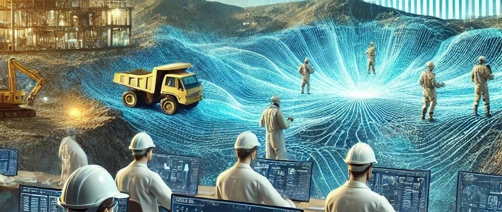
Machine Learning and 3D Mapping Techniques: Revolutionizing Geological Understanding Through Advanced Data Analysis
Xuan-Ce Wang
9/8/20254 min read
Introduction
The integration of machine learning algorithms and three-dimensional mapping techniques represents a paradigm shift in geological analysis, offering unprecedented capabilities for extracting valuable insights from complex geophysical datasets. These advanced computational approaches are transforming how geologists interpret subsurface structures and make critical decisions in mineral exploration and geological mapping.
Machine Learning in Geological Data Analysis
Multi-Dimensional Data Processing Capabilities
Machine learning algorithms excel at processing multiple input maps simultaneously within multi-dimensional space, revealing complex relationships between various geophysical datasets and established geological information. Advanced algorithms such as Random Forest and Support Vector Machines can identify patterns and correlations that would be challenging or impossible for human interpretation alone to detect.
Objective and Efficient Analysis Framework
The implementation of machine learning techniques introduces a more objective analytical process compared to traditional manual interpretation methods. By eliminating subjective bias and providing consistent analytical criteria, these algorithms can process vast datasets significantly faster than conventional approaches, enabling rapid preliminary assessments of large geological areas.
Training Data Integration and Pattern Recognition
The machine learning process begins with feeding algorithms carefully curated training data, including points where geology is definitively known through sampling, field observations, or drill log records. Input maps incorporating magnetic data, radiometric surveys, digital elevation models (DEM), and remote sensing imagery provide the foundational datasets for analysis.
Through this training process, algorithms learn to recognize characteristic signatures associated with different geological units, developing sophisticated pattern recognition capabilities that can be applied to classify raster data and generate predictive two-dimensional geological maps.
Applications and Benefits of Predictive Geological Mapping
First-Order Geological Information Generation
Predictive maps generated through machine learning serve as invaluable first-order geological information sources, particularly in areas where direct field mapping would be prohibitively expensive or logistically impossible due to accessibility constraints. These maps provide preliminary geological frameworks that can guide subsequent detailed investigations.
Strategic Field Mapping Guidance
Machine learning-generated maps function as strategic tools for directing field mapping efforts by highlighting specific areas of geological interest or uncertainty. This targeted approach optimizes field work efficiency and ensures that limited resources are allocated to the most promising or critical locations.
Geology Under Cover Analysis
Machine learning techniques prove particularly valuable for understanding geological structures beneath surface cover layers, where traditional surface mapping approaches are severely limited. Geophysical data can effectively "see through" these cover materials, revealing underlying geological architectures that would otherwise remain hidden.
Variable Importance and Uncertainty Quantification
Advanced techniques like Random Forest algorithms provide additional analytical insights by quantifying the relative importance of different variables (geophysical datasets) in geological prediction processes. These methods can generate comprehensive uncertainty maps showing probability distributions associated with classification decisions at each pixel, providing crucial information about prediction reliability.
Validation and Accuracy Assessment
Independent data validation represents a critical component of the machine learning workflow, enabling rigorous assessment of generated map accuracy and reliability. This validation process ensures that predictive models meet acceptable standards for geological interpretation and decision-making applications.
Three-Dimensional Geological Modeling Integration
Multi-Dataset Integration Framework
Building upon two-dimensional geological understanding derived from machine learning analysis, three-dimensional mapping techniques extend geological knowledge into comprehensive subsurface models. This integration process combines 2D geology maps, three-dimensional inversions of geophysical data (particularly magnetic datasets), drill hole logs, and additional geological datasets within sophisticated 3D workspace environments.
Manual Digitization and Geological Expertise Integration
The 3D modeling process involves geologists manually digitizing boundary lines (strings) that represent geological unit contacts, based on integrated data interpretation and professional geological knowledge. This human expertise component ensures that geological principles and field experience are properly incorporated into the modeling process.
Wireframe Construction and Boolean Operations
Specialized software tools connect digitized boundary lines to create comprehensive solid wireframes, which are subsequently refined through Boolean operations to produce final three-dimensional solid geology models. These models adhere to fundamental geological principles, including the law of superposition and structural relationships.
Three-Dimensional Model Applications and Insights
Subsurface Geological Visualization
Three-dimensional models provide detailed visual representations of subsurface geological architectures, revealing the complex geometry of geological units and structural features in comprehensive three-dimensional space. This enhanced visualization capability enables geologists to understand spatial relationships that are not apparent from two-dimensional surface data alone.
Buried Feature Identification
3D modeling techniques are particularly effective for identifying and characterizing buried geological features, including intrusive bodies, fault systems, and structural discontinuities that may not be detectable through surface mapping alone. These hidden features often play critical roles in mineral system development and resource distribution.
Mineral Exploration Enhancement
The enhanced understanding of subsurface geological architecture provided by 3D models is invaluable for mineral exploration applications. These models help refine mineral system conceptual frameworks, identify specific prospective zones where structural features intersect potentially mineralizing intrusions, and guide strategic planning for future exploration activities, including optimized drilling programs.
Dynamic Model Updating and Adaptability
Iterative Refinement Capabilities
Both two-dimensional and three-dimensional geological maps can be efficiently updated as new data becomes available or as geological understanding evolves through continued investigation. This adaptability ensures that models remain current and incorporate the latest available information.
Integration with Ongoing Exploration Programs
The dynamic nature of these modeling approaches allows for seamless integration with ongoing exploration programs, enabling continuous refinement of geological understanding as additional drill holes are completed, geophysical surveys are conducted, or field mapping programs provide new insights.
Complementary Role in Modern Geological Practice
Enhancement Rather Than Replacement
While machine learning and three-dimensional mapping represent powerful technological advances that significantly enhance the ability to extract geological information from geophysical datasets, these techniques are positioned as complements to, rather than replacements for, traditional field mapping and geological expertise.
Integration with Traditional Methods
The most effective geological interpretation strategies combine the analytical power of machine learning algorithms and 3D modeling capabilities with the irreplaceable value of field observations, geological experience, and professional judgment. This integrated approach leverages the strengths of both technological innovation and traditional geological practice.
Future Directions and Technological Evolution
As machine learning algorithms become more sophisticated and three-dimensional modeling capabilities continue to advance, the integration of these technologies with traditional geological methods will likely become even more seamless and powerful, opening new possibilities for geological understanding and mineral exploration success.
Conclusion
The integration of machine learning algorithms and three-dimensional mapping techniques represents a transformative advancement in geological analysis, providing unprecedented capabilities for extracting valuable insights from complex geophysical datasets. These technologies enhance objectivity, improve efficiency, and reveal geological relationships that might otherwise remain hidden, while maintaining the essential role of geological expertise and field-based observations in comprehensive geological interpretation. As these tools continue to evolve, their integration with traditional geological methods will undoubtedly lead to more effective mineral exploration strategies and enhanced understanding of Earth's subsurface architecture.
Below is the polished Chinese translation of the provided text, crafted to ensure accuracy, natural flow, and a professional tone suitable for the technical subject matter. The translation preserves the original meaning while adapting phrasing to sound idiomatic in Chinese. Headings and subheadings are formatted clearly using Markdown for readability.